Is the Kanal von Korinth still a dependable shortcut, or is it better understood as a spectacular landmark that may not be open when your itinerary reaches it? Conventional travel coverage tends to show the steep walls, passing boats, and dramatic viewpoints. That picture is incomplete.
The canal is also a working, constrained infrastructure asset. Its dimensions limit the vessels that can use it, its geology creates an ongoing stabilisation challenge, and recent restoration closures have made availability a practical issue for travellers, yacht operators, and maritime planners. This guide explains what the canal is, why it was built, how its structure affects navigation, and how to plan a visit without assuming that the passage is permanently available.
What Is the Kanal von Korinth and Why It Matters
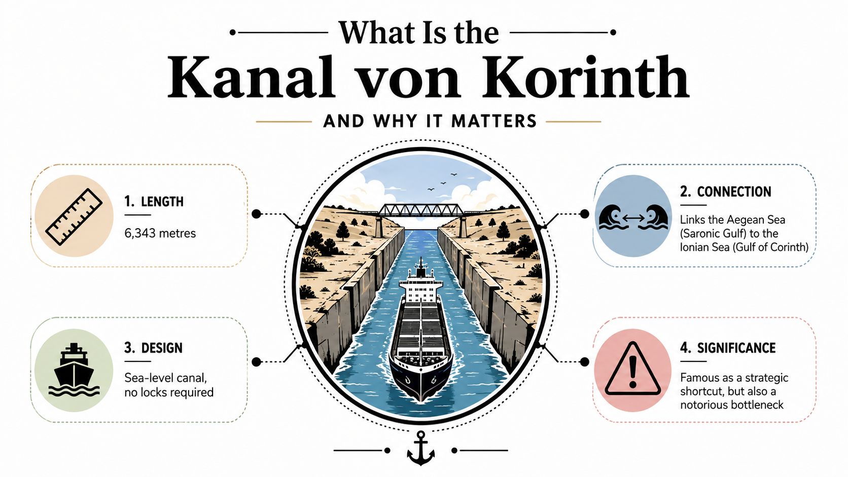
The Kanal von Korinth, or Corinth Canal, is a sea-level artificial waterway cut through the Isthmus of Corinth in Greece. It links the Aegean Sea, through the Saronic Gulf, with the Ionian Sea, through the Gulf of Corinth, giving vessels a direct passage instead of requiring a route around the Peloponnese. The official Peloponnese tourism description identifies the canal as a 6,343-metre waterway with a surface width of 24.6 metres, a bottom width of 21.3 metres, and a depth of about 7.5 to 8 metres.
Those measurements explain the canal's double identity. Visually, it feels immense because the waterway lies between steep, exposed walls. Operationally, it has a narrow envelope. Relatively small vessels can pass, but the canal isn't a modern route for every category of commercial ship. Its importance comes from the geographical connection it creates, not from unlimited capacity.
A landmark and a route
The canal matters to visitors because it turns geography into something visible. The isthmus is no longer an abstract strip of land between two bodies of water. You can stand above a straight, engineered cut and see how people altered the connection between two seas.
For operators, however, the key question is more practical: can a vessel of the required size pass, and is navigation permitted on the planned date? The canal has no locks because it runs at sea level. That makes the basic concept easy to understand, but it doesn't remove the constraints created by width, depth, bridges, and unstable slopes.
For Swiss travellers, this distinction is useful when comparing a fixed sightseeing stop with a planned boat crossing. A viewpoint visit may still be worthwhile even when navigation is suspended, but a sailing itinerary needs current operational confirmation. The canal is famous enough to appear permanent in holiday material, yet recent operator notices show that its availability can change significantly.
Practical rule: Treat the Kanal von Korinth as both a destination and an operating facility. Check its status before you build a journey around a crossing.
From Ancient Ambition to 19th-Century Construction
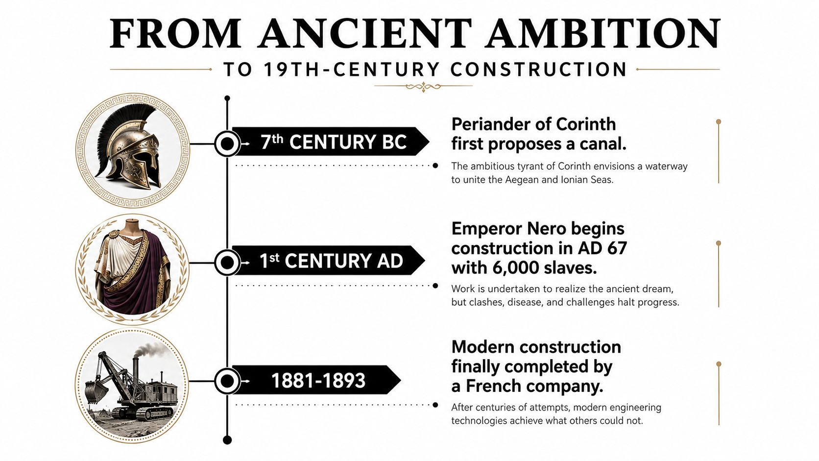
Could a waterway across the Isthmus of Corinth ever be more than a bold idea on a map? The goal was to let ships avoid the longer journey around the Peloponnese by cutting directly through the land. According to the canal operator's historical account, an early proposal is attributed to Periander in the 7th century BC.
Ancient planners also considered a land route. Ships and cargo could be hauled across the isthmus instead of moving through a navigable channel. This reduced the need for massive excavation, but it could not provide the same direct maritime connection. The route solved a transport problem in a different way, while the canal remained the larger ambition.
Nero's attempt
The Roman emperor Nero attempted construction in AD 67. His project showed that political authority and organised labour could be assembled around the idea, yet it did not produce a completed canal. Later generations faced the same geographic obstacle and returned to the same solution, a direct cut through the isthmus.
The repeated failures reflected the terrain as much as the limits of ancient technology. Excavating a sea-level passage required removing vast amounts of material, controlling steep ground, and dealing with the behaviour of local rock and sediment. On a map, the isthmus looks like a narrow barrier. On the ground, it presented a long sequence of difficult engineering decisions.
The industrial breakthrough
Modern construction began in 1882, and the canal opened in 1893 after 11 years of work, ending more than two thousand years of repeated but unsuccessful ambitions, as the documented canal history explains. Industrial excavation, improved surveying, organised finance, and the political conditions of late 19th-century Greece combined to make the project achievable.
The completed canal became more than a transport route. It marked a national engineering achievement and changed the physical appearance of Greece. For visitors, the straight excavation made history tangible, bringing together industrial scale, geography, and the drama of a narrow cut through the isthmus.
Completion did not end the engineering story. Water connecting both ends was only the beginning of ongoing management. Slopes require inspection, navigation requires control, and repairs become necessary when geological conditions affect safe passage. The Kanal von Korinth therefore represents two realities at once: an ancient ambition finally realised, and infrastructure whose usefulness depends on continued care rather than on its historic opening alone.
Engineering Specifications and Geological Challenges
Why does the Kanal von Korinth look so dramatic while handling only a limited range of vessels? Its dimensions explain the difference. The canal stretches 6,343 metres, with a navigable surface width of 24.6 metres, a bottom width of 21.0 metres, and a uniform depth of 8.0 metres, according to the engineering field-trip guide from the University of Athens. Bridges above the channel allow a maximum air-draft of 52 metres.
A vessel must fit the entire three-dimensional space, not just the waterline. Its beam must suit the channel, its draught must remain within the available depth, and its highest equipment must clear the bridges. The result is a tight operating envelope. From above, the straight cut may appear simple, but a confined passage leaves limited room for error, passing manoeuvres, or changes in vessel design.
| Measurement | Value | Practical implication |
|---|---|---|
| Total length | 6,343 m | A direct cross-isthmus route |
| Width at water surface | 24.6 m | Limits beam and passing space |
| Width at bottom | 21.0 m | Confirms the confined underwater profile |
| Navigable depth | 8.0 m | Excludes vessels needing greater draught |
| Maximum air-draft | 52 m | Bridges restrict vertical clearance |
Why the slopes are the central problem
The harder engineering problem lies beside the water. Geological research describes the canal as cutting through highly faulted Neogene and Quaternary sediments, including silty marl, marly sandstone, conglomerates, and marly limestone. A geotechnical study on fault rupture and slope behaviour identifies 52 main faults and steep artificial walls of about 71° to 77°.
Weak, fractured ground can deform, shed rocks, or develop landslides. Strong earthquakes raise the risk, while ordinary erosion and gradual movement also demand inspection. Stabilisation is therefore part of the canal's operating model, rather than an exceptional repair after an otherwise trouble-free period.
That geological burden explains why a famous viewpoint can also be a maintenance warning. The walls create the landmark's scale and visual drama, yet they also make safe passage dependent on monitoring, restoration, and closures when work is required. The Kanal von Korinth is an engineered waterway with firm physical limits, not a guaranteed scenic shortcut.
Economic and Navigational Reality in 2026
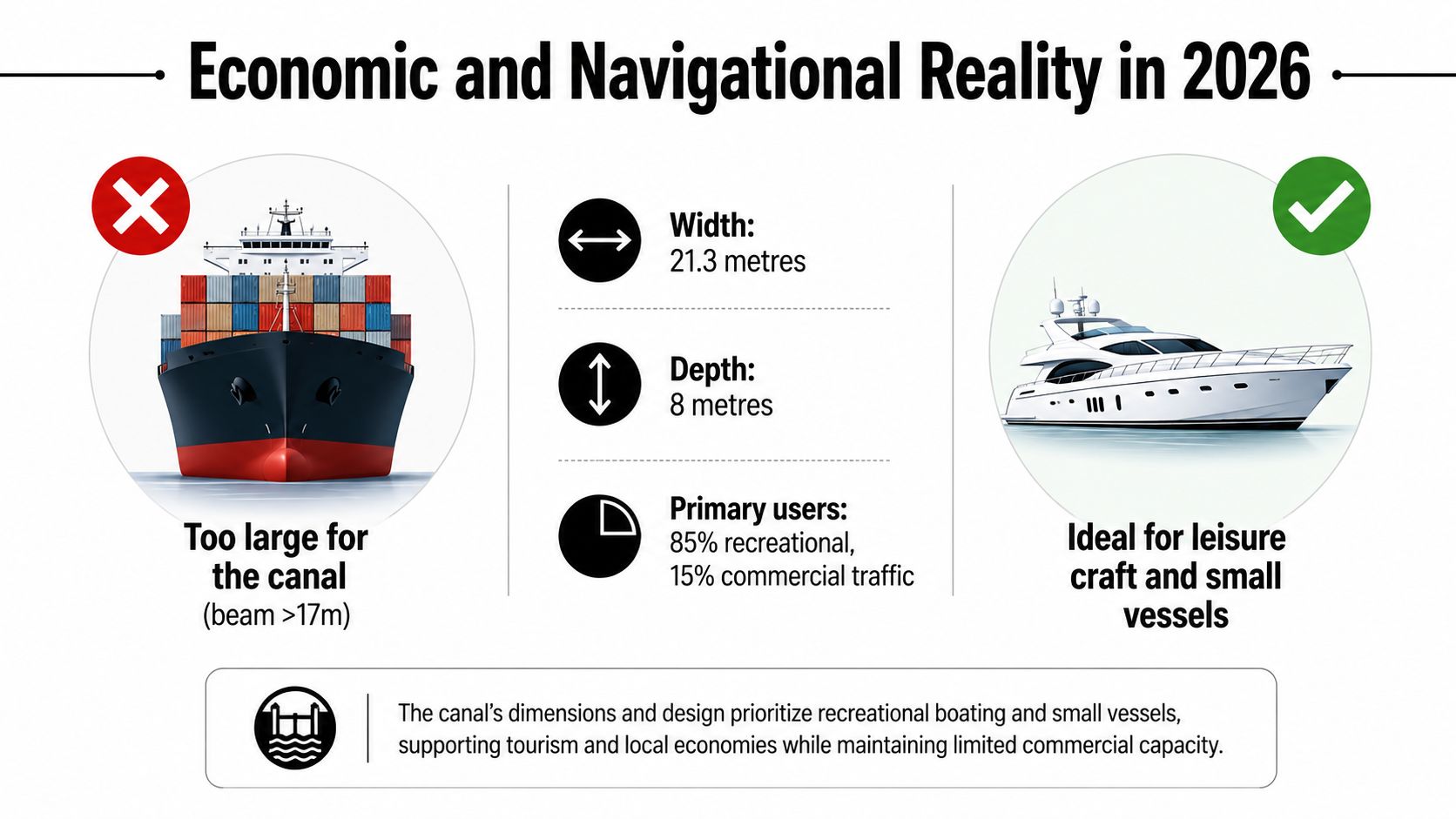
The Kanal von Korinth is often described as a strategic shipping shortcut, but that phrase needs qualification. Its geography is strategically useful, yet its physical scale makes it a niche routing option, not a mass transit corridor. A recent Swiss travel-industry report describes the channel as about 6.3 kilometres long, with a width around 17 metres and steep sides reaching roughly 79 to 85 metres, restricting it to narrow vessels (AboutTravel's report on the reopening).
That distinction changes how you should interpret its economic role. The canal can provide a convenient crossing for suitable vessels, including leisure craft and selected smaller maritime traffic. It cannot serve every ship that dominates contemporary global trade. Large cargo vessels need room for their beam, draught, manoeuvring, and operational safety, while the canal's narrow profile places hard limits on compatibility.
Who benefits from the passage
The most visible users are likely to be the vessels that fit the canal's envelope and have a reason to save the longer route. Leisure yachts and smaller boats gain a direct, memorable passage. Some cruise itineraries may also treat the crossing as an experience, provided the vessel meets the restrictions and navigation is open.
For these users, the value isn't measured only in cargo capacity. The canal offers a distinctive route, a strong tourism image, and a direct link between two maritime regions. Local businesses also benefit from visitors who stop at viewpoints, combine the canal with nearby archaeological sites, or include it in a broader Peloponnese journey.
The vulnerability is just as important as the convenience. Repeated restoration closures during the recent period show that the canal's current story is less about expanding throughput and more about maintaining safe operation. An asset can remain culturally important and economically useful without being a large-scale shipping artery.
The canal's modern importance lies in selective convenience and visual impact, not unlimited capacity.
Swiss travel planners should therefore avoid presenting a crossing as a guaranteed feature of a Greek sailing holiday. For a road trip, a closure may change only the viewing experience. For a boat itinerary, it can require a larger route decision.
Closures, Restoration, and Trip Planning Reliability
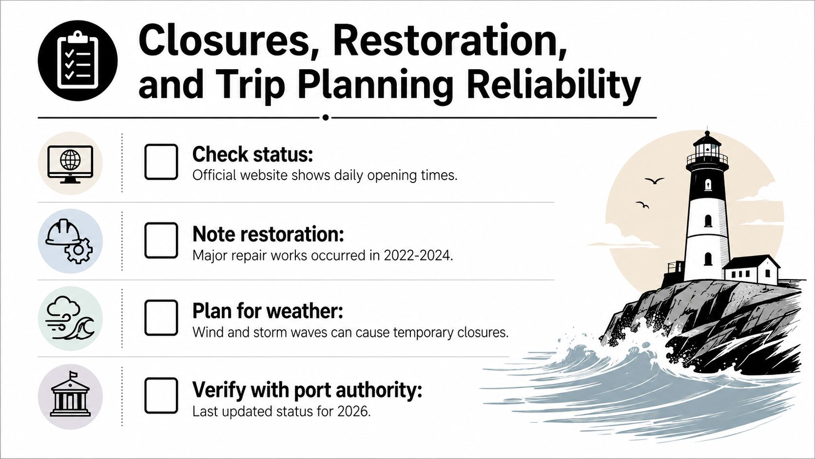
The most useful question before visiting is simple: will the canal be open on the date that matters to you? Recent notices make a cautious approach necessary. The operator records a reopening for navigation on 8 March 2025, a scheduled closure from 14 October 2025 for the final restoration phase, and a further reopening in June 2026 after more than six months of repairs (official Corinth Canal notices).
These dates show why older travel pages can mislead even when their descriptions are accurate. A page may correctly explain the canal's location and history while saying nothing about whether boats can pass during your trip. Restoration schedules can also change as engineers inspect slopes, complete protective work, and confirm that navigation can resume safely.
A practical verification routine
Use a short sequence rather than relying on a booking page or an old blog post:
- Check the operator's current notice. Look for the latest navigation status, reopening information, and restoration announcements on the official canal website.
- Separate viewing from crossing. A road journey may still reach a viewpoint when marine navigation is suspended, but a boat trip depends on formal permission to pass.
- Ask the vessel operator directly. Yacht charter companies, cruise planners, and local skippers can confirm whether a planned itinerary has been adjusted.
- Keep a route alternative. If the crossing is central to your schedule, allow flexibility for a longer sea route or a different day.
- Recheck close to departure. A notice issued during planning isn't a permanent guarantee, especially while restoration remains an active concern.
What restoration means
Slope stabilisation addresses the physical margins of the canal. Engineers need to reduce the risk of rockfalls and deformation on steep walls formed in fractured, relatively weak geological materials. The work can require restricted access or a full navigation suspension because crews and vessels can't safely share the same operating space during major interventions.
The embedded video offers visual context for the canal and its restoration environment:
For the 2026 travel season, the June reopening is encouraging, but it shouldn't replace a current status check. A reopening answers whether navigation has resumed at that point. It doesn't promise that every later date will be unaffected by repairs, inspections, weather, or operational decisions.
How to Visit the Kanal von Korinth
A visit works best when you decide first whether you want a view of the canal or an actual passage through it. These are different experiences with different risks. A road traveller can usually treat the canal as one stop on a broader route, while a sailor must confirm vessel compatibility and navigation status before committing to the itinerary.
From the Athens side, the canal fits naturally into a journey towards the Peloponnese. From the Peloponnese side, it can serve as an opening or closing stop before continuing towards destinations such as Ancient Corinth, Mycenae, or Nafplio. The geography makes it easy to combine with other places rather than treating it as an isolated excursion.
Viewpoints and access
The road bridges provide the most immediate views into the cut. Look for safe, designated pedestrian areas rather than approaching the edge of the walls. The height and steepness can be deceptive, and some sections may not have the protection visitors expect from a formal attraction.
A submersible bridge offers a different perspective at water level when access and operating conditions permit. It helps explain the canal as an active transport facility, not only as a scenic gorge. The highest bridge is also associated with a bungee-jumping platform, but that activity requires its own operator checks, age and health requirements, and safety instructions.
Follow these habits during a stop:
- Stay behind barriers: Never climb onto an unguarded edge or walk across a vehicle lane for a photograph.
- Watch the surface: Dust, loose stones, heat, and traffic can make informal paths less suitable than they appear.
- Respect closures: If an access point is closed, don't search for an unofficial route along the rim.
- Bring water and sun protection: Exposed viewpoints can feel harsh in warm weather, particularly during the middle of the day.
- Allow time for observation: The scale becomes clearer when you watch the relationship between a vessel, the waterway, and the walls.
If you're organising several stops for clients, a clear digital itinerary can help travellers understand the difference between a scheduled viewpoint and an optional boat activity. A guide to trip pages for tour operators can be useful for presenting those plans in an organised format without making a crossing sound guaranteed.
If the canal is closed
A closure doesn't automatically make the stop pointless. You can still use accessible viewpoints, learn about the engineering work, and continue to nearby historical sites. The important adjustment is to remove the expectation of a boat passing below you.
Shoulder-season travel can make the visit more comfortable and may reduce pressure at popular viewpoints, but it isn't a substitute for checking the operating notice. Pack the canal into a flexible Peloponnese loop, keep the stop relatively compact, and let current access determine whether you add a crossing, a bridge visit, or an observation point.
Why the Kanal von Korinth Still Matters
The Kanal von Korinth matters because it makes a large geographical idea tangible. The sea-level cut connects the Aegean and Ionian seas through the Isthmus of Corinth, but its significance isn't limited to the route it provides. The waterway also records the persistence of an engineering ambition that began with ancient proposals and reached completion only in the industrial age.
Its scale creates the central contradiction. The canal is long enough to transform regional navigation, yet narrow and shallow enough to exclude many modern vessels. Its steep walls make it visually unforgettable, yet the same slopes require continual geological attention. Its identity as a tourist attraction rests partly on an infrastructure system that must sometimes close so engineers can protect those walls.
Recent restoration closures have changed the sensible way to plan a visit. A traveller who checks the latest operator notice can enjoy the canal without confusing a famous image with a guaranteed service. A skipper who verifies navigation status and vessel suitability treats the route with the seriousness its dimensions demand.
Visit for the history and the landscape, but plan like you're approaching working infrastructure.
That balance is the best way to understand the canal in 2026. It isn't a failed giant or an all-purpose shipping artery. It's a constrained, sometimes-closed landmark whose value comes from the relationship between human ambition, maritime geography, tourism, and unstable ground.
Check the current status before departure, build in an alternative if a crossing matters, and combine the canal with the wider Peloponnese. The experience is strongest when you see both sides of it: the dramatic landmark from above and the carefully managed waterway that remains below.
beautysecrets.agency applies the same careful eye to natural, ethically sourced beauty as a geographer applies to a complex scene, selecting certified formulations for Swiss pharmacies, retailers, spas, hotels, and premium e-commerce partners. Visit beautysecrets.agency to explore its curated portfolio and discover clean-beauty lines suited to thoughtful retail and wellness experiences.